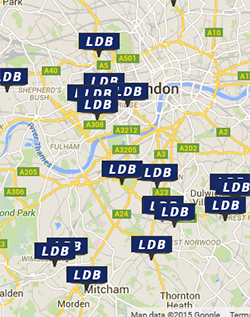
Technical Web Services offer online database driven mapping solutions based on OpenLayer maps.
The service is designed to be basic in nature but effectively scalable and powerful. TWS can develop back end databases that you can populate with data including map references based on Latitude and Longitude coordinates.
This can then be leveraged through a web based interface for a GIS program, on screen interrogation tool or simply to profile a map location with a given data set, for example, depot locations.
The service can also be integrated into customer sites, or even other customers (non TWS) sites in support of features such as project mapping, gazetteers and holiday destinations etc.
Filters can be offered to allow for active filtering and searching as required.
Essentially if you have an idea for a map based internet development then give us a call.
The map below shows the location of the TWS office. Any number of icons, within reason, can be applied with bespoke graphics, and functionality can be applied to filter results, for example, projects by type or year.
“Simple map solutions for websites based on dynamic editable data based on the Google maps interface.”